METAR-TAF
Aeroports :
Cut Bank, Montana, Estats Units d'Amèrica
latitud: 48-36-30N, longitud: 112-22-34W, altitud: 1175 m
Observació
L'informe es va fer fa 46 minuts, a les 15:56 UTC
Vent 6 kt del Sud/Sud-Oest
Temperatura 19°C
Humitat 64%
Pressió 1016 hPa
Visibilitat: 16.1 km
Cel clar
METAR: KCTB 091556Z AUTO 21006KT 10SM CLR 19/12 A3000 RMK AO2 SLP129 T01940122
Hora: 10:42 (16:42 UTC)
Pronòstic
L'informe es va fer fa 4 hores i 9 minuts, a les 12:33 UTC
Pronòstic vàlid del 09 a les 13 UTC al 10 a les 12 UTC
Vent 6 kt del Nord-Oest
Visibilitat: 10 km
Escasses núvols a una alçada de 200 ft
Temporalment
l' 09 a les 13 UTC al 09 a les 15 UTC
l' 09 a les 13 UTC al 09 a les 15 UTC
Visibilitat: 4.8 km
Cel cobert a una alçada de 200 ft
boirina
A partir de les 09 a les 1700 UTC
Vent 15 kt del Oest/Sud-Oest amb ràfegues de 24 kt
Visibilitat: 10 km
Cel clar
A partir de les 10 a les 0300 UTC
Vent 9 kt del Oest/Sud-Oest
Visibilitat: 10 km
Escasses núvols a una alçada de 25000 ft
TAF: KCTB 091233Z 0913/1012 31006KT P6SM FEW002 TEMPO 0913/0915 3SM BR OVC002 FM091700 25015G24KT P6SM SKC FM100300 25009KT P6SM FEW250
Observacions i pronòstics meteorològics de més de 4000 aeroports (METAR i TAF).
Les estacions disponibles són els punts grocs i vermells al mapa.
Posi el ratolí al punt desitjat per veure el nom de l'estació.
Feu clic per veure les observacions i els pronòstics meteorològics.
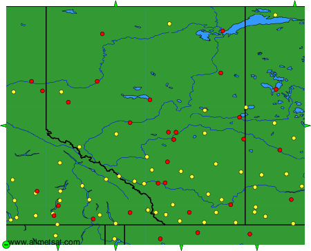
Per canviar el mapa: feu clic els botons verds amb una creu de color negre per apropar; al botó verd amb un guió per allunyar la imatge; o en les fletxes verdes per a mapes adjacents.