METAR-TAF
Aeroports :
Rhinelander
Adrian
Alma
Alpena
Angola
Ann Arbor
Antigo
Appleton
Auburn
Aurora
Bad Axe
Baraboo-Wisconsin Dells
Battle Creek
Beaver Island
Bellaire
Benton Harbor
Big Rapids
Burlington
Cadillac
Camp Douglas
Caribou Island
Caro
Charlevoix
Charlotte
Cheboygan
Chicago
Chicago-Midway
Clinton
Clintonville
Coldwater
Copper Harbor
Defiance
DeKalb
Detroit
Detroit
Detroit
Detroit-Grosse Ile
Eagle River
Elkhart
Escanaba
Flint
Fond du Lac
Frankfort
Freeport
Gary
Gaylord
Gore Bay
Goshen
Grand Rapids
Grayling
Green Bay
Hancock
Harbor Springs
Hillsdale
Holland
Houghton Lake
Howell
Iron Mountain-Kingsford
Ironwood
Jackson
Janesville
Joliet
Juneau
Kalamazoo-Battle Creek
Kenosha
Lambertville
Land O' Lakes
Lansing
Lansing
Lone Rock
Ludington
Mackinac Island
Madison
Manistee
Manistique
Manitowoc
Marquette
Marshall
Marshfield
Mason
Medford
Menominee
Merrill
Midland
Milwaukee
Milwaukee
Mineral Point
Minocqua-Woodruff
Monroe
Monroe
Morris
Mosinee
Mount Clemens
Mount Pleasant
Munising
Muskegon
Newberry
Oscoda
Oshkosh
Owosso
Pellston
Peru-LaSalle
Phillips
Pontiac
Port Hope
Port Huron
Racine
Rhinelander
Rochelle
Rockford
Rogers City
Romeoville
Saginaw
Saginaw
Sault Ste. Marie
Sault Ste. Marie
Sault Ste. Marie
Savanna
Shawano
Sheboygan
South Bend
South Haven
Sterling-Rock Falls
Stevens Point
Sturgeon Bay
Sturgis
Toledo
Toledo
Tomahawk
Traverse City
Troy
Valparaiso
Warsaw
Watertown
Waukegan
Waukesha
Waupaca
Wausau
West Bend
West Chicago
Wheeling-Prospect Heights
Windsor
Wisconsin Rapids
Michigan
Amèrica del Nord
Illinois
Indiana
Iowa
Minnesota
Ohio
Ontàrio, Nord
Ontàrio, Sud
Wisconsin
Rhinelander-Oneida County Airport Rhinelander, Wisconsin, Estats Units d'Amèrica
latitud: 45-37-54N, longitud: 089-28-56W, altitud: 495 m
Observació L'informe es va fer fa 52 minuts, a les 08:53 UTC
Vent 7 kt del Sud
Temperatura 3 °C
Humitat 56 %
Pressió 1016 hPa
Visibilitat: 16.1 km
Cel cobert a una alçada de 9000 ft
METAR: KRHI 250853Z AUTO 17007KT 10SM OVC090 03/M05 A3000 RMK AO2 PRESFR SLP170 T00281050 58033
Hora: 04:45 (09:45 UTC) Pronòstic L'informe es va fer fa 4 hores i 25 minuts, a les 05:20 UTC
Pronòstic vàlid del 25 a les 06 UTC al 26 a les 06 UTC
Vent 5 kt del Sud/Sud-Est
Visibilitat: 10 km
Cel ennuvolat a una alçada de 15000 ft
A partir de les 25 a les 0800 UTC
Vent 5 kt del Sud/Sud-Est
Visibilitat: 10 km
Cel ennuvolat a una alçada de 9000 ft
A partir de les 25 a les 1100 UTC
Vent 5 kt del Sud/Sud-Est
Visibilitat: 10 km
Cel ennuvolat a una alçada de 9000 ft
A partir de les 25 a les 1900 UTC
Vent 6 kt del Sud-Oest amb ràfegues de 17 kt
Visibilitat: 10 km
Núvols disperses a una alçada de 20000 ft
A partir de les 25 a les 2300 UTC
Vent 4 kt del Oest/Sud-Oest
Visibilitat: 10 km
Núvols disperses a una alçada de 25000 ft
TAF: KRHI 250520Z 2506/2606 15005KT P6SM BKN150 FM250800 16005KT P6SM BKN090 FM251100 16005KT P6SM BKN090 FM251900 23006G17KT P6SM SCT200 FM252300 24004KT P6SM SCT250
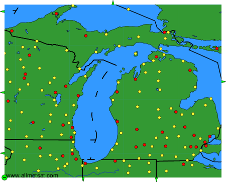
Observacions i pronòstics meteorològics de més de 4000 aeroports (METAR i TAF).
Les estacions disponibles són els punts grocs i vermells al mapa.
Posi el ratolí al punt desitjat per veure el nom de l'estació.
Feu clic per veure les observacions i els pronòstics meteorològics.
Per canviar el mapa: feu clic els botons verds amb una creu de color negre per apropar; al botó verd amb un guió per allunyar la imatge; o en les fletxes verdes per a mapes adjacents.