METAR-TAF
Aeroports :
Revelstoke
Agassiz
Banff
Banff
Blue River
Bow Island
Bow Valley
Brooks
Buffalo Narrows
Buffalo Narrows
Calgary
Calgary-Springbank
Cardston
Castlegar
Chetwynd
Claresholm
Clinton
Cold Lake
Coronation
Cranbrook
Creston
Crowsnest Pass
Cut Bank
Cypress Hills
Dawson Creek
Drumheller
Eastend Cypress
Edmonton
Edmonton
Edmonton Namao
Edson
Esther
Fort Chipewyan
Fort McMurray
Fort St. John
Golden
Grande Prairie
Havre
High Level
Hope
Jasper
Jimmy Lake
Kalispell
Kamloops
Kelowna
Kindersley
Lac La Biche
Leader
Lethbridge
Lloydminster
Lucky Lake
Lytton
Maple Creek
Meadow Lake
Medicine Hat
Milk River
Nakusp
Nelson
North Battleford
Omak
Onefour
Osoyoos
Peace River
Penticton
Pincher Creek
Princeton
Princeton
Red Deer
Revelstoke
Rocky Mountain House
Rosetown
Salmon Arm
Sandpoint
Slave Lake
Sparwood
Sparwood
Spirit River
Spiritwood
Suffield
Summerland
Sundre
Swift Current
Three Hills
Uranium City
Val Marie
Vegreville
Vernon
Villeneuve
Waterton Park Gate
Whitecourt
Yoho National Park
Alberta
Amèrica del Nord
Colúmbia Britànica
Idaho
Montana, Est
Montana, Oest
Nunavut
Saskatchewan
Territoris del Nord-oest
Washington
Yukon
Revelstoke, Colúmbia Britànica, Canadà latitud: 50-58N, longitud: 118-11W, altitud: 443 m
Observació L'informe es va fer fa 19 minuts, a les 09:05 UTC
Vent 3 kt amb direcció variable
Temperatura 7 °C
Humitat 81 %
Pressió 1010 hPa
Visibilitat: 14.5 km
Cel ennuvolat a una alçada de 8100 ft Cel cobert a una alçada de 10000 ft
METAR: CYRV 250905Z AUTO VRB03KT 9SM BKN081 OVC100 07/04 A2982 RMK SLP112
Hora: 02:24 (09:24 UTC) TAF: manca
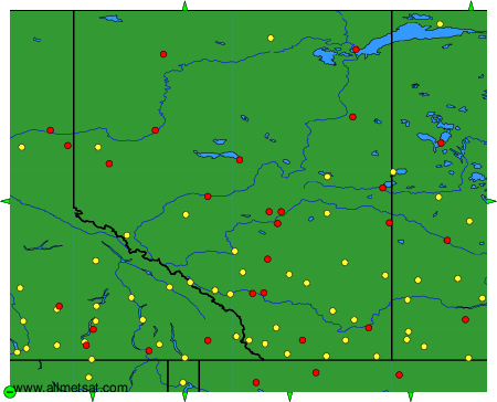
Observacions i pronòstics meteorològics de més de 4000 aeroports (METAR i TAF).
Les estacions disponibles són els punts grocs i vermells al mapa.
Posi el ratolí al punt desitjat per veure el nom de l'estació.
Feu clic per veure les observacions i els pronòstics meteorològics.
Per canviar el mapa: feu clic els botons verds amb una creu de color negre per apropar; al botó verd amb un guió per allunyar la imatge; o en les fletxes verdes per a mapes adjacents.